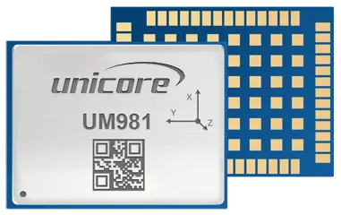
UM981 is Unicore's new-generation proprietary RTK and INS integrated navigation module. It can simultaneously track multiple satellite systems and frequencies, including GPS, BDS, GLONASS, Galileo, QZSS, NavIC and SBAS. The module integrates a high-speed floating point processor and an RTK dedicated coprocessor, being able to output positioning data at 100Hz. The on-board MEMS chip and U-Fusion integrated navigation algorithm ensure continuous positioning when loss of lock on GNSS signals occurs, providing high-quality positioning results in complex environments such as building blocks, tunnels, overpasses and tree shades. UM981 and UM981S are designed for high-precision navigation and positioning application, with UM981 for precision agriculture and UM981S for surveying and mapping, respectively.
Based on Unicore's proprietary GNSS SoC NebulasIV that integrates RF, baseband and high-precision algorithm
All-constellation multi-frequency RTK engine and advanced RTK technology
Instant RTK initialization technology
60 dB narrowband anti-jamming and jamming detection
Heading2 technology to provide heading information
STANDALONE single-station high-precision positioning technology
Supports B2b-PPP and E6-HAS
On-board MEMS integrated navigation and U-Fusion technology to ensure continuous positioning when loss of lock on GNSS signals occurs
Channel | 1408 channels, based on NebulasIV | |||
Frequency | GPS L1C/A, L1C, L2C, L2P(Y), L5 | |||
BDS B1I, B2I, B3I, B1C, B2a, B2b | ||||
GLONASS G1, G2, G3 | ||||
Galileo E1, E5a, E5b, E6 | ||||
QZSS L1C/A, L1C, L2C, L5, L6 | ||||
NavIC L5 | ||||
SBAS L1C/A | ||||
Single Point Positioning(RMS) | Horizontal: 1.5m | |||
Vertical: 2.5m | ||||
DGPS (RMS) | Horizontal: 0.4m | |||
Vertical: 0.8m | ||||
RTK (RMS) | Horizontal: 0.8cm+1ppm | |||
Vertical: 1.5cm+1ppm | ||||
PPP(RMS) | Horizontal: 5cm | |||
Vertical: 10 cm | ||||
Tilt Measurement(UM981S) | 10 mm + 0.7 mm/°tilt (accuracy < 2.5 cm within 30°) | |||
Positioning Error of INS only | < 5 % of the distance traveled without GNSS signals | |||
Observation Accuracy (RMS) | BDS | GPS | GLONASS | Galileo |
B1I/B1C/L1 C/A/G1/E1 Code | 10 cm | 10 cm | 10 cm | 10 cm |
B1I/B1C/L1C/A/G1/E1 Carrier Phase | 1 mm | 1 mm | 1 mm | 1 mm |
B2I/B2a/B2b/L5/E5a/E5b Code | 10 cm | 10 cm | 10 cm | 10 cm |
B2I/L2P(Y)/L2C/G2/E5b Carrier Phase | 1 mm | 1 mm | 1 mm | 1 mm |
B3I/B2a/E5a/L5 Code | 10 cm | 10 cm | 10 cm | 10 cm |
B3I/B2a/E5a/L5 Carrier Phase | 1 mm | 1 mm | 1 mm | 1 mm |
Time Accuracy (RMS) | 20 ns | |||
Velocity Accuracy (RMS) | 0.03 m/s | |||
Cold Start | < 12 s | |||
Initialization Time | < 5 s (typical) | |||
Initialization Reliability | > 99.9% | |||
Data Update Rate | 100 Hz (IMU RAW Data) | |||
50 Hz* (RTK) | ||||
Differential Data | RTCM V3.X | |||
Data Format | NMEA-0183, Unicore |
Packaging | 54 pin LGA |
Dimension | 17.0 × 22.0 × 2.6 mm |
Weight | 1.91 g ± 0.03 g |
Working Temperature | -40 °C ~ +85 °C |
Storage Temperature | -55 °C ~ +95 °C |
Humidity | 95% No condensation |
Vibration | GJB150.16A-2009, MIL-STD-810F |
Shock | GJB150.18A-2009, MIL-STD-810F |
2 x UART (LVTTL)(UM981) |
3 x UART (LVTTL)(UM981S) |
1 x I2C* |
1 x SPI* |
1 × CAN*(UM981) |
Note: Items marked with * are only supported by specific firmware.