Real-Time Kinematic (RTK) - Beyond Just GPS
If you've ever used GPS for navigation, you might have experienced the convenience of knowing your exact location in real-time. But what if we told you there's a technology that takes GPS accuracy to a whole new level? Enter Real-Time Kinematic (RTK) - a game-changer in the world of Global Navigation Satellite Systems (GNSS Navigation).
RTK is a technique used to enhance the accuracy of GNSS positioning. While traditional GNSS receivers provide meter-level accuracy, RTK takes it a step further by enabling centimeter-level precision. How does it work? Well, it's like having your own personal guide walking beside you, providing instant corrections to your location as you move.
How Does RTK GNSS Work?
RTK GNSS works by employing two GNSS receivers: a base station and a rover. The base station, which is positioned at a known location with precise coordinates, acts as the reference station. It continuously receives satellite signals and calculates the difference between the actual coordinates and the known coordinates.
Meanwhile, the rover, which is the GNSS receiver used for navigation or surveying, receives signals from the same satellites as the base station. The rover then uses the correction data sent by the base station to calculate its own position in real-time. This correction data eliminates errors caused by atmospheric disturbances and other factors, allowing the rover to achieve centimeter-level accuracy.
The process of real-time correction between the base station and the rover is what makes RTK so powerful. It ensures that the rover's positioning is constantly updated with high precision, providing accurate and reliable data for various applications.
Advantages of RTK GNSS:
1. High Precision: The most significant advantage of GNSS RTK is its unparalleled accuracy. With centimeter-level positioning, it is ideal for applications that require precise geospatial data, such as land surveying, construction, and precision agriculture.
2. Real-Time Data: As the name suggests, RTK GNSS provides real-time data. This means you can access accurate positioning information instantly, allowing for quicker decision-making and improved productivity in the field.
3. Improved Efficiency: RTK GNSS streamlines surveying and navigation tasks by reducing the need for manual post-processing and enabling faster data collection. This efficiency translates to cost savings and increased project turnaround times.
4. Versatility: RTK GNSS can be utilized in various industries and applications, including robotic mowers, UAVs, deformation monitoring, and handheld GIS devices. Its versatility makes it a valuable tool for professionals in different fields.
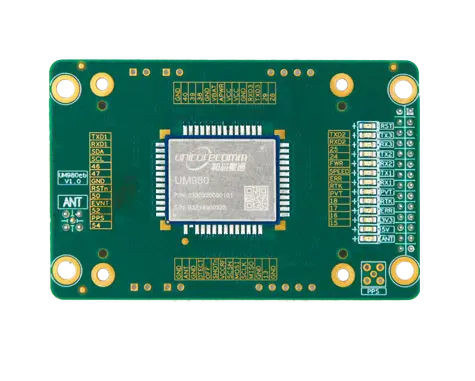
For those seeking advanced GNSS solutions with RTK capabilities, Unicore Communications offers the UM960 module. With its high position fix rate, multi-constellation support, and low power consumption, the UM960 empowers professionals with cutting-edge real-time positioning technology. Whether you're navigating with a UAV, monitoring deformations, or engaging in precision agriculture, the UM960 RTK module from Unicore Communications is your ticket to achieving accuracy and efficiency like never before. Embrace the power of RTK GNSS and unlock the full potential of centimeter-level positioning in your projects today!

 EN
EN  JP
JP  ko
ko  fr
fr  de
de  es
es  vi
vi  it
it  pt
pt  ms
ms  sv
sv  CN
CN


