Email Us
UM982C

UM982C

GPS/BDS/GLONASS/Galileo/QZSS All-constellation Multi-frequency High Precision Positioning and Heading Module
UM982C-1

Brief Introduction

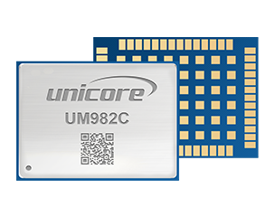
UM982C is Unicore's new-generation proprietary all-constellation, multi-frequency high-precision GNSS positioning and heading module, developed based on the GNSS SoC NebulasIV which integrates RF, baseband and high-precision algorithm. The module supports all-constellation multi-frequency on-chip RTK positioning and dual-antenna heading solution, supports QZSS L6D (CLAS) PPP-RTK solution, and supports  TruePoint|REACH Sat L-band-based PPP-AR service. UM982C can be used as a rover or a base station for applications such as UAV, precision agriculture, and autonomous machine.


UM982C supports configuring the multi-system joint positioning mode or single-system standalone positioning mode, and tracking multiple signals. With the built-in anti-jamming unit, the module ensures accurate positioning even in complex electromagnetic environments. 


UM982C has various types of interfaces for different purposes, including UART, I2C*, SPI*, PPS, EVENT and CAN*.


Features

  • Based on Unicore's proprietary GNSS SoC NebulasIV which integrates RF-baseband and high-precision algorithm

  • All-constellation, multi-frequency on-chip RTK positioning and dual-antenna heading solution

  • Dual RTK engine using master-slave antenna GNSS raw observations for independent positioning solution

  • Excellent anti-jamming and anti-spoofing capabilities, supporting jamming detection and spoofing detection

  • Adaptive recognition of RTCM format differential data

  • STANDALONE single-station high-precision positioning technology

  • Supports B2b-PPP, E6-HAS and QZSS L6E (MADOCA) PPP and SouthPAN L5 PVS 

  • Supports QZSS L6D (CLAS) PPP-RTK solution

  • Supports TruePoint|REACH Sat L-band-based PPP-AR service1


Technical Specifications

Performance Specifications


Channel
1408 channels, based on NebulasIV
Master Antenna
Slave Antenna
GPS L1C/A, L2P(Y), L2C, L5
GPS L1C/A, L2C
BDS B1I, B3I, B2a, B2b*BDS B1I, B3I
GLONASS G1, G2-
Galileo E1, E5a, E5b, E6Galileo E1, E5b
QZSS L1C/A, L1C/B, L2C, L5, L6QZSS L1C/A, L2C
L-Band*
-
Single Point Positioning (RMS)Horizontal: 1.5m
Vertical: 2.5m
DGPS (RMS)
Horizontal: 0.4m
Vertical: 0.8m
RTK (RMS)Horizontal: 0.8cm+1ppm
Vertical: 1.5cm+1ppm
PPP (RMS)2
Horizontal: 5cm  @20min
Vertical: 10cm     @20min
PPP-AR (RMS)2
Horizontal: 3cm  @5min
Vertical: 6cm       @5min
CLAS (RMS)2
Horizontal: 5cm  @1min
Vertical: 10cm     @1min
Observation accuracy (RMS)BDSGPSGLONASSGalileo
B1I/L1 C/A/G1/E1 Code10cm10cm10cm10cm
B1I/L1C/A/G1/E1 Carrier Phase1mm1mm1mm1mm
B2I/L5/E5a/E5b Code10cm10cm10cm10cm
B2I/L5/E5a/E5b Carrier Phase1mm1mm1mm1mm
B3I/L2P(Y)/L2C/G2 Code10cm10cm10cm10cm
B3I/L2P(Y)/L2C/G2 Carrier Phase1mm1mm1mm1mm
Heading Accuracy 
0.1°/1 m baseline
Time Accuracy
20 ns
Velocity Accuracy (RMS)
0.03 m/s
TTFF
(Time to First Fix)

Cold Start < 30s
Hot Start 4s
Initialization Time
<5s (typical)
Initialization Reliability
>99.9%
Data Update Rate20 Hz (RTK+Heading)
Differential DataRTCM V3.X
Data FormatNMEA 0183, Unicore


Physical Characteristics

Packaging48 pin LGA
Dimension16.0 × 21.0 × 2.6 mm
Weight1.82±0.03g


Environmental Specifications

Working Temperature-40°C~+85°C
Storage Temperature-55°C~+95°C
Humidity95% No condensation
VibrationGJB150.16A-2009, MIL-STD-810F
ShockGJB150.18A-2009, MIL-STD-810F


Communication Interface

3 × UART 
1 × SPI*
1 × I2C*
1 × CAN* (share the pin with UART3)


Note: Items marked with * are only supported by specific firmware, 1. This is is a paid service, 2. Under open sky and without jamming.


Download

CONTACT
Subscribe
Subscribe to get news updates from us
We use cookies to allow our website to function properly, personalize content,advertising, and analyze traffic. Respect for your privacy is central to our policy. Detailed information about our privacy and cookie policy can be found in the enclosed sections. Thanks in advance for your cooperation. More info...
Reject Accept