Email Us
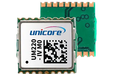
UM220-IV M0

UM220-IV M0

Industrial Grade Multi-GNSS Navigation and Positioning Module

UM220-IV M0 is a multi-system compact navigation module designed for the automotive market. As the fourth generation of GNSS navigation and positioning module, UM220-IV M0 is based on Unicore's proprietary GNSS SoC UC6226. It is highly integrated, with low power consumption, anti-jamming design, compact size, and is suitable for applications requiring low cost.


Ordering Information

Supply at multiples of 1000 pieces


gps plus glonass

Product Characteristics

  • Ultra-small packaging

  • Compact design, small size

  • Excellent performance, supporting single-system standalone positioning and multi-system joint positioning

  • Anti-jamming technology, which enables the module to work stably in complex electromagnetic environments

  • Low power consumption

  • Suitable for large-scale applications that require high performance, small size and low cost


Technical Specifications

Performance Specifications


Channel

64 channels, based on UFirebird

Frequency1GPS L1
BDS B1

GLONASS G1

Galileo E1

QZSS

SBAS

Modes

Single-System Standalone Positioning

Multi-System Joint Positioning

Time to First Fix (TTFF)2

Cold Start: < 28 s

Hot Start < 1 s
Reacquisition: < 1 s

AGNSS < 4 s

Positioning Accuracy(CEP)3

Horizontal: 2.0 m

Vertical: 3.0 m

Velocity Accuracy(RMS)3
0.1 m/s (GNSS)

1PPS

Support

SensitivityGNSS

Tracking            -161 dBm

Acquisition        -147 dBm

Hot Start           -155 dBm

Reacquisition    -158 dBm

Update Rate

1 Hz
Data FormatNMEA 0183, Unicore


Physical Specifications

Dimensions

9.7 x 10.1 x 2.2 mm

Package

18 pin SMD

Temperature

Operating -40 °C ~ +85 °C

Storage -45 °C ~ +90 °C

Electrical Specifications

Voltage3.0 V ~ 3.6 VDC
LNA Feed

3.0 V ~ 3.3V, < 100 mA

Power Consumption490 mW


Functional Ports

1 x UART (LVTTL)

1 x 1PPS (LVTTL)


Functional Characteristics

Passive Antenna, Active Antenna

AGNSS *

NOTE: Supported by specific firmware

1 Simultaneously running three systems at most.Using

command to switch between BDS and GLONASS. 2 Open sky.

3 Typical value <30m/s open sky.

4 Open sky, continuous tracking.

Download

Product Data Sheet Request
Comprehensive product feature specifications.

Please provide your contact information via this contact form and we will email you an electronic copy of the comprehensive product data sheet immediately. Select the subscription option to be sent future versions of the data sheet as new data is added, or amendments are applied.

subscribe to document updates
CONTACT
Subscribe
Subscribe to get news updates from us
We use cookies to offer you a better browsing experience, analyze site traffic and personalize content. By using this site, you agree to our use of cookies. Visit our cookie policy to learn more.
Reject Accept